

About · The Project
Understanding how fishing cats live in Colombo
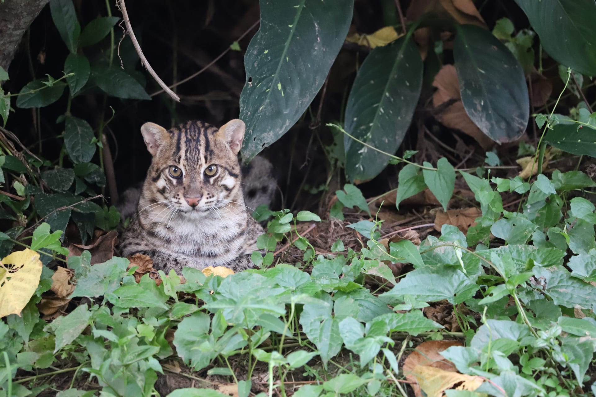
Colombo is home to the world’s only known urban population of fishing cats. Our project was established to understand how these cats survive in a city shaped by wetlands, canals, roads, and people.
Project origins
Why the project began
When the project began, very little was known about fishing cats in Colombo. Occasional sightings confirmed that they were present, but there was no long-term research on how they used the city, whether they were confined to the wetlands, what they relied on, or how urban development was affecting them.
The first surveys focused on confirming where fishing cats occurred. Camera traps and public reports soon recorded them beyond protected wetland boundaries, including canals, gardens, golf courses, and residential neighbourhoods. Rather than occupying isolated pockets of habitat, fishing cats were using a connected urban landscape. Understanding that landscape became just as important as studying the cats themselves.
As new discoveries raised new questions, the research expanded from documenting where fishing cats occurred to examining movement, habitat use, diet, mortality, and landscape connectivity.

Urban context
Colombo is not one habitat
Wetlands remain the ecological core of the study area, but fishing cats do not move through them alone. Canals, gardens, road verges, drains and small patches of vegetation can form routes between larger areas of habitat.
Much of this movement takes place after dark. A fishing cat may leave a wetland, follow a canal through a residential area, cross a road and enter land managed by another household, business or public agency. No single site or land manager controls the entire route.
Studying these movements has shown where parts of the city remain connected and where animals are forced through narrow or hazardous passages. These patterns help identify where roads create barriers, where development may fragment habitat, and where small changes could improve ecological connectivity across the city.

Much of this ecological network exists in plain sight, yet few people realise it functions as a connected ecosystem.
-

01 Wetland
-

02 Canal
-
03 Vegetated edge
-

04 Road verge
-

05 Passage


Research development
How the research developed
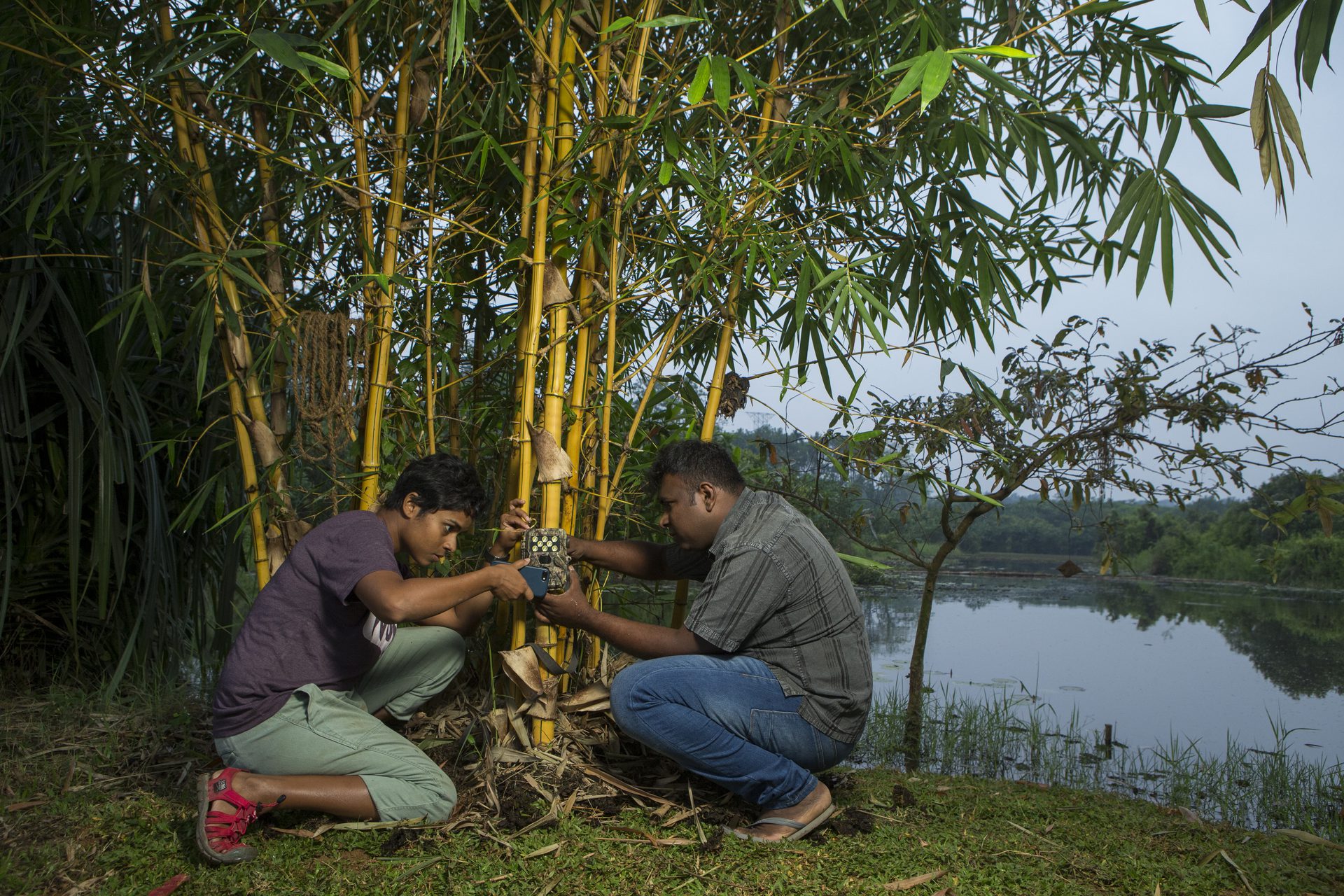
Early camera-trap surveys established where fishing cats occurred and allowed individual animals and activity patterns to be monitored over time. These records showed where cats occurred, but they could not explain how individuals travelled between detection sites.
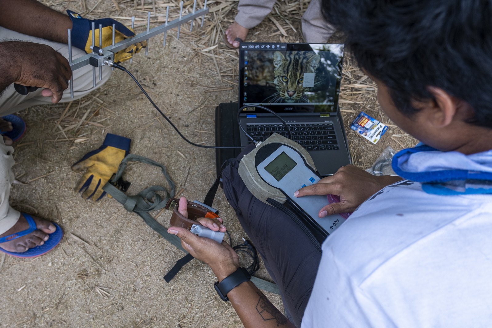
GPS tracking revealed how fishing cats moved between wetlands, canals, gardens, and neighbourhoods, documenting routes that camera traps alone could not reveal.
Diet studies identified the prey supporting the urban population while revealing that plastic pollution was moving through Colombo’s wetland food web to reach fishing cats through their prey.
As the research programme matured, mortality records and road ecology shifted attention towards the broader landscape, examining how infrastructure influences wildlife movement, connectivity, and survival.
-
Camera trapping
-
GPS tracking
-

Diet research
-
Roads and connectivity


Programme continuity
A long-term research programme
Our research is not a series of separate projects. The work has developed as a long-term research programme in which new studies build on earlier monitoring, records and partnerships.
That continuity matters in a city that is constantly changing. Wetlands are restored, degraded or fragmented. Roads are widened. New infrastructure changes how animals move. A short survey can describe what is happening at one point in time, but it cannot show whether those patterns persist.
Returning to the same sites and collecting comparable data allows changes in fishing cat activity, habitat use, movement and risk to be examined over time. It also allows new observations to be interpreted against records collected years earlier.
-

Revisiting a monitoring station
-

Repeat survey along an established route

The long-term record
Evidence built over time
The programme’s datasets become more useful as records accumulate across years. The figures below represent defined phases of the research and should be read within that context.
Programme duration
- Since 2013
- Long-term research in Colombo
2021–2022 intensive survey
- 14,867
- Camera-trap nights
- 1,330
- Fishing cat detections
- 12
- Individually identified fishing cats across three core study sites
- 117
- Wildlife species recorded
Diet research
- 293
- Fishing cat scats collected for diet research
Tracking
- First in Sri Lanka
- GPS-collared fishing cats
Wider relevance
From one population to wider conservation questions
Fishing cats remain the focus of our research, but they are also a window into the wider ecology of urban landscapes. Following where they move, what they eat, and the habitats they depend on reveals how wetlands, canals, gardens, road verges, and other green spaces function as connected ecological systems supporting many different species.
Camera traps document mammals, birds, reptiles, and amphibians using the same habitats. Public reports extend observations beyond formal study sites, while collaborative monitoring explores similar questions in forest fragments, road corridors, and other human-modified landscapes across Sri Lanka.
This work allows the programme to examine broader questions about wildlife movement, habitat connectivity and the conservation of biodiversity within landscapes shaped by people.


Applied conservation
Where the research is applied
Research findings help guide future studies, identify priorities for monitoring, and contribute to discussions about wetland management, infrastructure planning, habitat connectivity, and wildlife conservation.
Public reports extend monitoring beyond formal study sites. Education and community engagement return research findings to the people who share these landscapes, while collaboration with government agencies, universities, conservation organisations, and land managers helps ensure the evidence contributes to practical conservation and planning.
Not every finding leads immediately to a visible intervention. Some strengthen the long-term record, refine a research question or show where more evidence is needed. This is part of building conservation decisions on information rather than assumption.


Continuing the record
Why the work continues
Colombo is still changing. Wetlands are altered, roads are expanded and new development affects how animals move between the habitats that remain. Continued monitoring allows those changes to be compared with the records already collected, rather than treating each new survey as an isolated snapshot.
The programme now combines long-term monitoring in Colombo with research on connectivity, roads and other human-modified landscapes. Colombo remains the core study system and the source of the programme’s longest ecological record. As the research continues, that record becomes increasingly valuable for understanding how wildlife responds to a rapidly changing city.
Support the programme
Continue the long-term record
Long-term ecological research depends on continuity. Donations help support field equipment, repeat surveys, transport, and data processing, allowing us to revisit monitoring sites, investigate new questions, and extend one of the world’s longest-running studies of an urban fishing cat population.
